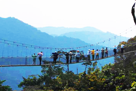
5-Days Mountaineering of Rwenzori Mountains in Uganda.
We allow 1-day of travel to Kasese and the whole drive will take us about 8 hours through the Kampala - fortportal - Kasese highway, we shall do some shopping and get ready for the 5 days trek of the Rwenzori mountain.
We spend our night at The white house Hotel in Kasese town or Trekkers hostel in Kyanjiki.
5 Day Trek to Kiharo Camp - Rwenzori Mountains National Park
The trek starts at Trekkers Hostel in Kyanjiki 12 kilometres from Kasese past Kilembe. Best to start by 8.30am but can leave as late as 10am. Meet your guides and briefing. You walk 2.2km to the UWA rangers post at 1,727metres.
Here the rangers brief you on the day's activities and rules of the National Park.
Today's walk 8.6 km expected time 5 to 6 hours Start height is 1,667 metres climbing to 3,171 metres
The first two kilometres climbs steadly through prestine montane forest, with tall trees thick undergrowth and a multitude of different species of birds and primates. Then a fairly strenuous climb up a main ridge with few rocks and firm footing except immediately after a heavy downpour climbing to your first night at Samalira Camp. As you leave the rangers post you walk along a path through tall grassland and ferns which gives way to magnificent pristine forests.
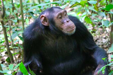
As this is a new route the forests are untouched and carry a wide variety of trees and plants. Many species of birds can be heard and seen in this rich environment. The first few kilometres climb steadily crossing several small streams and rivers then we start climbing the ridge. As we climb the trees become taller and straighter and it is common to see and hear many types of primates, on the left you may hear troupes of chimpanzee echoing around the valleys. Particularly around our lunch spot at 2,570m it is possible to see troupes of 15 to 20 black and white Colobus monkeys or Blue monkeys as they dash through the trees.
After lunch we continue to climb steadily passing a rock shelter (2,785m) previously used by poachers to hunt primates and dika (small antelope) After the rock shelter the climb enters the bamboo zone and becomes steeper. As we near the top we break out of the bamboo to fantastic views of the valleys and hills below looking across to Lake George and Queen Elisabeth National Park in the distance. The equator lies just north of Lake George. Samalira Camp is at 3,147 metres, meaning views or lookout and offers great views of the surrounding landscape and Kasese town. (Mobile network available at this camp)
After a hearty breakfast we commence walking at 8:15am and initially climb steadily then cross a small stream and the climb becomes steep for about 200 metres up a narrow moss covered ridge. The thick moss covering the ground and rocks under the giant heather trees is spectacular and we ask you to help preserve this prestine environment by keeping to the pathway. The views give us the impression that we could fly as we look across the many ridges and valleys far below. You can see Kilembe village deep in the valley and across Lake George.
After a relatively short climb the trail becomes less steep as we pass over Chavumba (meaning heaven) at 3,316m them cross a small flat valley to climb up a steady ridge through moss covered trees and misty forests to the top of the ridge at 3,515 metres. Here we descend steadily for about one kilometre before descending a steep drop with good footing of 200 metres into the Nyamwamba valley and a well earned lunch break at Poly's Rock Shelter 3,249 metres.
After lunch we climb steadily above the Nyamwamba River for 1.6km though old giant heathers covered in old man's beard moss to Kiharo Camp at 3,380 metres directly at the base of some good granite rock climbs of 20 to 40 metres, with towering peaks above. Here if you have the energy you may decide to do a spot of rock climbing before settling down for the evening. Sleep in Kiharo Camp
After the early morning breakfast in Kiharo Camp we climb a steep section passing around and through huge moss covered bolders. At times you get glimpses of the cliffs towering above as you move through thick forests of giant heather trees. The surroundings are evergreen as moss covers rocks and trees and is possibly the most beautiful section in the entire Rwenzori Mountains.
After about 1km you pass below some high cliffs and beautiful open basins which were formally the final resting bed of huge glaciers as the melted millions of years ago. About three kilometres up the valley you turn left up a valley to Lake Nsuranja and cross to the top of a steep drop to Mutinda Rock Shelter, here you can stand on the edge of the cliffs and get excellent views of Mutinda Peaks before descending to the valley far below. You cross a fast flowing river then climb up to the shelter. Mutinda Rock Shelter is big enough for more than eighty people to sleep and offers a large dry area where you can relax and enjoy the unique atmosphere of the Rwenzori Mountains.
The distance from Mutinda to Kalalama Camp is 5.1km however before you descend you may climb up to Mutinda lookout at 3,975 metres and which takes about 45 minutes to one hour then about 30 minutes to descend. Mutinda Lookout (see picture below) is the lowest and flatest peak of Mutinda Peaks where on a clear day you get fantastic views of the mountain range and down across the foothills to Kasese town, Queen Elisabeth National Park and beyond. After enjoying the view and the unique atmosphere you descend to the rock shelther for a cuppa tea and something to eat before continuing to Kalalama camp perched on a high ridge overlooking the Rwenzori foothills and Lake George.
After a cuppa we descend down a series of rocky streams and valleys often passing along river beds or rock hopping as we descend down to Kalalama Camp 3,134 metres. This section is absouletly amazing as we hop across the moss covered rocks in this unique environment which is closed inbetween huge cliffs creating a different micro-environment. As we near Kalalama Camp we pass though a beautiful flat valley dotted with about 150 Gaint Lobelia. After passing the Lobelia garden we climb to walk along a ridge down to Kalalama Camp which is perched on a high ridge overlooking the Kilembe valley and Kasese town. Sleep in Kalalama Camp
We descend down through the bamboo forests. Here we cross to the trail climbing to Samalira camp just above the lunch spot on day one. Here we have a short break before we walk the final distance through mountain montane forest to the Rangers Post 1,727 metres. After debriefing, we sign off and walk down to Trekkers Hostel. Some fast walkers have descended to the rangers post by midday however the majority of people arrive at the rangers post around 3pm.
If you are strong enough,you will get back in time and drive back to Kampala, arriving late at 7:30pm.
For detailed and more tailor made itineraries, feel free to contact us at tours@adventure-travellers.com
Most Popular Uganda Safaris
© 2025 African Adventure Travellers. All Rights Reserved.


